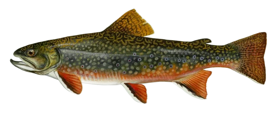
Colorado outings to investigate
These selected examples are not live fishing recommendations. Use the planner to filter by date, county and walking, and check current notices before departure.
North Fork Poudre (Cherokee Middle Unit)
Cherokee SWA · Larimer County · Historical CPW field account
Colorado Outdoors, CPW's magazine, describes mostly Brook and Brown Trout in the North Fork accessed through Cherokee SWA's Middle Unit. It provides a brook-specific reason to investigate this canyon. Colorado Outdoors: North Fork outing.
This 2015 account is not a current survey. CPW's current reach page emphasizes browns and occasional rainbows; it does not independently quantify today's brook population. This is historical guide evidence, not confirmed present-day dominance.
- Access
- Use marked Cherokee Middle Unit parking off Larimer County Road 80C and CPW's current property map. The historical route is about two miles each way from an inner 4WD parking area; a closed outer gate adds about two miles each way. Plan for the longer walk unless the land manager confirms vehicle access. Remain within public boundaries. CPW: SWA rules and unit maps.
- Season
- The field account favors spring around runoff and fall, and warns about hot, low summer water. Exact best months are not established. September 1–May 1 the SWA is open only for hunting and fishing; other permitted uses resume May 2–August 31. Foot-only access applies after the last big-game season. Verify gates. Seasonal evidence.
- Rules
- Divide Creek downstream to Bull Creek: artificial flies and lures only; release all trout immediately. Visitors age 16+ need a valid fishing or hunting license or SWA pass; a pass alone is not a fishing license. Follow current SWA use rules and private boundaries. Official rules.
Hunter Creek (Upper Valley)
Aspen · Pitkin County · Published brook-focused account
The Daily Sentinel's small-water guide distinguishes Hunter Creek's steep lower section from its flatter upper valley, described as mostly inhabited by Brook Trout with some cutbows. Daily Sentinel: Hunter Creek.
This is a 2018 editorial account, not a current fish survey. Do not apply its upper-valley recommendation to the steep lower creek or assume historical dominance guarantees a catch.
- Access
- Use USFS-described lower trailhead parking on Lone Pine Road: from Mill Street bear left onto Red Mountain Road, then right onto Lone Pine Road; parking is on the left. Follow the public Hunter Valley route uphill to the flatter valley using the official map. Do not shortcut through housing or private parcels. USFS: Hunter Valley trailheads.
- Season
- The account favors late summer and fall for small streams, without exact opening dates or months. Snow and mountain weather can prevent an outing. The first three miles are heavily used by hikers, cyclists and dogs; follow current trail rules. Seasonal evidence.
- Rules
- Check Colorado fishing regulations, USFS orders and public boundaries. Hunter Valley Trail is outside wilderness; the upper Hunter Creek Trail enters Hunter–Fryingpan Wilderness, where additional restrictions apply. USFS requires dogs on leash. Official rules.
South Mesa Lake
Grand Mesa · Mesa County · Official brook fishery support
The Forest Service specifically identifies a naturally reproducing Brook Trout population in South Mesa Lake, rather than relying on trout reports for nearby Mesa or Lost lakes. USFS: Grand Mesa short hikes.
The brochure does not establish present abundance, fish size or catch probability. Nearby lakes have different species and stocking histories; those claims are not applied here.
- Access
- Use designated Glacier Springs / Mesa Lakes parking shown in the USFS trail guide. Follow Mesa Lake Shoreline Trail #503 to Lost Lake Trail #502, which USFS identifies as fishing access to South Mesa Lake. Consult the map at the junction so you do not continue to the wrong lake. USFS: Lost Lake Trail access.
- Season
- USFS says trails are generally snow-free July to mid-October, not all of October. Check snow, thunderstorms, day-use fees and current access before setting out. Seasonal evidence.
- Rules
- A Colorado fishing license and current lake-specific rules apply. Follow public routes, posted trail restrictions and current USFS orders. Do not apply nearby lakes' rules or stocking reports here. Official rules.
Big Meadows Reservoir (North Shore)
Mineral County · Colorado · Guide-supported mixed fishery
South Fork’s visitor guide specifically recommends the reservoir’s banks and north-shore fishing pier for Rainbow, Brown and Brook Trout. USFS confirms public parking and reservoir access. South Fork: Big Meadows fishing guide.
Mixed-fishery visitor guidance, not a brook-dominance survey or recent stocking confirmation. Big Meadows is distinct from nearby Shaw and Hunter’s lakes.
- Access
- From US 160 take Forest Road 410 west to the signed junction, then bear right on Road 430 to the public boat-ramp parking lot. Follow established access to permitted north-shore fishing areas and the accessible pier identified by South Fork’s guide. USFS: Big Meadows parking and route.
- Season
- USFS describes the boating site as normally open from Memorial Day weekend until freeze-up, usually in November. The review uses June–October as a conservative planning window inside that approximate season, not a legal opening or guaranteed ice-free dates. Seasonal evidence.
- Rules
- Carry the required Colorado fishing license and check current CPW regulations and posted notices. Visitors age 16+ need a valid hunting or fishing license or SWA pass; a pass alone does not authorize fishing. Follow posted no-wake rules and use public shore only. Official rules.
Identification reviewed 2026-09-30. Destination sources and their limitations are shown beside each outing. Photos and illustrations are identification references, not local catch reports.